4. The Wedge
The Wedge is the jewel of the Organs. It stands at the southern end of a long series of jagged needles which look like shark's teeth as seen from the Cuevas. Its great chiseled arrowhead, with the pure, knifelike W Ridge and serrated SE Ridge framing the sheer 1000 foot granite cliff of its S Face, dominates any view of the central Organs from the west. The Wedge's solid, rosy monzonite is as good climbing rock as any in the Organs.
Return to the Top of The Wedge Route Descriptions
4a. Normal Route |
Class: 3 |
3� - 4 hours |
First ascent: 17 May 1934; S. Christensen
|
From the Cuevas strike northeast around its western end along a shallow arroyo, pass through a gate into grazing land, then follow the disused jeep road which is encountered until it ends in the faint remains of an old mine. Climb the hill to the north and bear east on a fairly clear trail on the north side of a small box canyon terminating in a small waterfall draining Fillmore Canyon. (A tongue of military reservation land must be crossed here; inquire locally about the necessity of securing permission to cross Fort Bliss Artillery Range land and also privately-owned land in this vicinity.) Continue on this trail to a point about 30 yards past a gate in an old fence, then leave it to strike north (directly toward the Wedge). With luck you find yourself upon an ancient mining road, surfaced with rounded boulders, which saves some bushwhacking. Follow this to a point about 1/2 mile past a ruined stone shack, then bear east up a hill crowned with a great leaning squarish block. (Here the old Modoc Mine Road, unhappily not viable in its lower parts, comes into view several hundred yards to the north.) Continue up this welt descending from the gendarmes at the bottom of the Wedge's W Ridge until a point about 100 yards short of its first rock shoulder, then traverse right into the deep arroyo between it and the welt to the east. The proper place to cross this arroyo is a fairly spacious expanse of bare water-smoothed rock (Olhausen's Oasis, the First Canonical Resting Place). From here admire the mighty slabs of the Wedge's S Face, already considerably foreshortened. Mount the welt to the east along a faint trail winding through large boulders to where it abuts on the slopes of the West Side, several hundred yards southwest of a large shoulder distinguished by the extremely smooth slabs of its SW Face (the Big Tooth). Here this "trail" forks, the left branch contouring into the deep, wooded gully which leads up to the Wedge's S Face, the right fork going right and upward around the base of the Big Tooth. Take the right fork and pursue it, bushwhacking, to the Ballroom, a vast expanse of smooth rock, tilted at an angle of 30�, clearly visible from the Cuevas (This is the Second Canonical Resting Place). Leave the Ballroom by its upper lefthand corner, penetrate a bit of bush which soon gives way to a miniature pine forest, and attain the notch marking the low point of the Organ Ridge south of the Wedge. From this notch a series of buttresses march down the West Side, culminating in the Big Tooth. Cross to the East Side at the notch and traverse around a minor tower on the Organ Ridge via a clear, spacious ledge. Drop down through a scrub oak forest into the deep gully which descends the East Side from the col at the base of the SE Ridge of the Wedge. The approach walk proper ends here. Climb up the E Side of the Wedge in the easy gully to the left, negotiating a 3rd Class jam crack about midway, to the saddle at the top of the large shoulder which composes the E Side of the Wedge. Choice of the other gully, to the right, lands you in greater difficulties. From this saddle climb directly up 3rd Class rock on the NE Side of the main block of the Wedge to the summit 250 feet above.
The view of the Organ Range from the Wedge's summit is magnificent. Practically every peak in the Organs can be seen from here, as well as mountain ranges hundreds of miles away in three states and in Mexico.
Descend by climbing or rappelling down the last 250 feet of the ascent to the saddle. Or, go down the SE Ridge about 100 yards until an easy traverse on the NE Side to this saddle is espied. (This variation can also be used on the ascent.) Then drop down along the N Side to the col between the Wedge and Lost Peak, its neighbor to the north. From here beat down the narrow brushy gully between these two peaks until the approach route for the W Ridge of the Wedge Route (Route 4b) is joined, then retrace it to the Cuevas. From the saddle on the back side of the Wedge one can also return by retracing the approach route, though this is longer than the return route just described.
Return to the Top of The Wedge Route Descriptions
4b. W Ridge |
Class: medium 5 |
5� - 6 hours |
First ascent: R. Robbins, P. Rogowski, H. Davis, T. McCalla
|
This ridge, which looks like a smooth knifeblade when viewed from the west, resolves itself into a series of shoulders, which are the terminations of steep shelving ledges running across the S Face, when seen from the south.
Follow the approach route of Route 4a as far as the beginning of the traverse to Olhausen's Oasis. Continue up this welt to a clearcut saddle beneath the gendarmes at the end of the W Ridge. Strike up through steep brushy terrain, keeping the gendarmes on your right. There is an elusive trail here, which eliminates much bushwhacking, if you are fortunate enough to find it. You attain a saddle from which you can slip into the narrow gully which mounts between the W Ridges of the Wedge and Lost Peak. Continue up this gully until a roofed chimney with exit through a hole in the top is passed, then climb immediately onto the W Ridge. This point is just below two great wide parallel grooves in the W Ridge, visible from afar. The approach ends here. The first ascent party climbed a high 5th Class friction pitch (the "zeroth pitch") just below this point, which is avoided by using the roofed chimney in the gully. Climb just north of the two great grooves to a good belay spot on the First Shoulder, from which a steep shelf drops down the S Face into the Green Band, a prominent horizontal band of brush and good sized trees about midway up the Face. The next pitch is the most difficult of the climb and an ingenious exercise in route-finding. Go out onto the N Side, work into a poor jam crack nearest the Ridge, then with a delicate balance manuever step out onto the Ridge. From here traverse out 10 feet onto the S Face to a bucket handhold, then climb straight up on vertical rock until a marvelous left handhold on the top of a flake removes all doubt as to the essential benevolence of the Great Belayer. A few feet farther lies the belay spot on the top of the Second Shoulder. The next pitch goes up a steep slanting ledge on the south side of the next shoulder (the Great Shoulder, where the S Face Diagonal Route intersects the W Ridge). Then climb a large crack on the S Face; the exit from an awkward niche is best done by a chimneying movement with one's back to the crack and feet on shelving holds on one wall, owing to the total lack of handholds above the niche. The final pitch goes directly up the Ridge on small holds over moderately inclined rock.
Return to the Top of The Wedge Route Descriptions
4c. S Face, Diagonal Route |
Class: medium 5 - medium 6 |
6� - 7� hours |
First ascent: R. Ingraham, R. Hahn, H. Fisher
|
This aery, beautiful route up the tremendous exposed slabs of the S Face is one of the classics of the Organs.
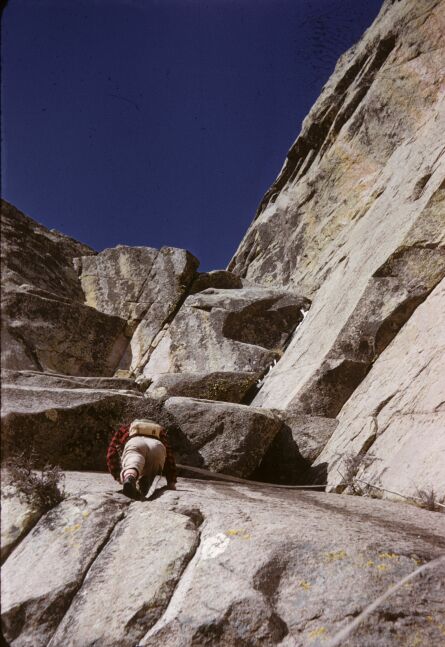 Approach as in Route 4a as far as the "trailforks" just beneath the Big Tooth. Take the left fork, bushwhack into a large gully full of boulders, then mount straight up to a gigantic pine at the bottom of the S Face. Head right along the bottom of the Face to a point about midway between the pine and the col on the Organ Ridge, where an obviously feasible crack heads up and left onto the Face. Before engaging the first pitch, a "shillelagh" (a stout piece of green wood about 2 inches thick and 2 feet long) should be cut for use above. (It is possible that wide enough bong-bong angle pitons will render this device obsolete.) Climb up the right side of a prominent flake, then cross over its top and gain a good belay ledge provided with a stout tree. Then wriggle up a narrow inclined ledge for about 20 feet with the exposure on your left already well developed. From here easy scrambling takes you to the eastern end of the Green Band. Passing above the Band, head diagonally up the left side of the Upper Face. The first difficulty is the Shillelagh Overhang, a small overhang reached via a jam crack in the steep slab below it. Lean out from under the overhang under tension and throw the shillelagh, to which a 5 foot length of sling rope has been attached in the middle, into the upper part of the very wide vertical crack which splits it down the middle. This can be used as a handhold to muscle up over the overhang. Climb 30 feet straight up, then traverse right a few feet in a deep fissure, to the bottom of the Great Overhang, which is formed by the breaking off of the wide steep shelf descending from the Great Shoulder on the W Ridge. The next pitch is the crux, and is extremely enjoyable, if you enjoy exposure. Step up around a corner into a shallow niche beneath the lip of the overhang, then use a 6th Class sling in a bolt high on the right wall to reach a small ledge just over its upper lip. Continue up the steep shelf to the W Ridge, where Route 4b is joined.
Return to the Top of The Wedge Route Descriptions
4d. S Face, Direct Route |
Class: high 5 - high 6 |
1 - 2 days |
First ascent: R. Robbins, P. Rogowski
|
This route is one of the fairly numerous Organ routes which have never been repeated to date. It is a lengthy tension climb, the only one of its sort yet done in the Organs. It is also doubtless the most difficult route in the Organs; the first ascent occupied two days with a bivouac on the Green Band.
From the gigantic pine at the bottom of the S Face (see Route 4c) head up the steep slabs, following a series of parallel cracks which bear away to the left. When the first of a series of overhanging roofs, like a gigantic inverted staircase, is encountered, head slightly right through broken up overhangs and bulges. 500 feet above the base one attains the haven of the Green Band. Surmount an overhanging bit of the upper Face at its point of least height just above the tall pine at the eastern end of the Band and emerge upon the high angle rock of the eastern facet of the Face. Then follow a wide crack which runs straight up to the summit some 400 feet above.
Return to the Top of The Wedge Route Descriptions
4e. N Face |
Class: high 4 |
3� - 4 hours |
First ascent: R. Ingraham, P. Wohlt
|
Take the approach of Route 4b but continue up to the Wedge - Lost Peak Col. From here go directly up a large gully on the N Face, exiting from it on the left at its end. Shortly above, the top pitch of the Normal Route (Route 4a) is joined.
This material is from "A Climbing Guide to the Organ Mountains", Copyright by R.L.Ingraham, Privately published, 1960's.